On Monday the 18th December 2017 Dan and I set off for Hythe, for another Kent Coastal walk. We arrived in Hythe and parked up in West Parade where there is free parking. We walked down into the town to find a bus stop to take us to the beginning of the walk in Dover.
 |
| Hythe |

Up above us sat Dover Castle. Dover Castle’s position, commanding the shortest sea crossing between
England and the Continent, has given it immense strategic importance.
The chalk of Castle Hill has been shaped and reshaped over the centuries
into massive earthworks, ditches and mounds. Imposing walls and towers
have been raised and networks of tunnels built beneath them. King Henry
II began the building of the present castle in the 1180s, and over the
next 800 years its buildings and defences were adapted to meet the
changing demands of weapons and warfare.

Many centuries before King Henry II began the great stone castle here in
the 1180s, its spectacular location above the famous white cliffs may
well have been the site of an Iron Age hillfort.
The Romans built a lighthouse – one of the best-preserved in Europe – on
the heights here after they invaded in AD 43, to guide ships into the
harbour. The Anglo-Saxon church beside the lighthouse was once probably
part of a Saxon fortified settlement. Restored in the late 19th century
by Sir George Gilbert Scott and William Butterfield, it is the largest
and finest Saxon building in Kent.
Immediately after his victory at Hastings in 1066, William the Conqueror
strengthened the defences with an earthwork and timber-stockaded
castle. From then on Dover Castle was garrisoned uninterruptedly until
1958.
In the 1180s Henry II remodelled the castle, planning its great tower as
a palace in which to entertain great visitors as well as a last redoubt
for a strategically important castle. At 83 feet (25.3 metres) high,
just under 100 feet (30 metres) square and with walls up to 21 feet (6.5
metres) thick, it has three floors of rooms, the topmost being state
apartments for the king himself.
Within this magnificent showpiece, Henry could welcome and impress
distinguished visitors to England – particularly noble pilgrims
travelling to the new shrine in Canterbury Cathedral of Thomas Becket.
The archbishop was slaughtered in front of the altar there by Henry’s
household knights on 29 December 1170, ten years before the great tower
was begun. On the second floor of the great tower is a chapel dedicated
to Becket, with richly decorated stonework.
Building work continued in the first half of the 13th century under King
John and Henry III, who completed the successive rings of defensive
walls surrounding the great tower.
In 1216–17 these defences were twice put to the test when Dover
withstood a long siege by an invasion force led by Prince Louis of
France in support of English barons rebelling against King John. The
fortress resisted ten months of bombardment by siege engines,
undermining by tunnels and eventually hand-to-hand fighting.
Following the siege, John’s son Henry III added three powerful new
gatehouses and a fortified spur extension to the castle. By the 1250s
the medieval defences had assumed the extent and shape they retain
today, a highly visible symbol of English royal power.
In October 1265 the castle was again besieged, this time by Prince
Edward, Henry III’s son. Holding the castle was Eleanor de Montfort, the
king’s sister and widow of rebel baron Simon de Montfort, who had been
killed at the Battle of Evesham that summer. Attacked not only from
outside but by royalist prisoners inside the castle, Eleanor negotiated
an honourable settlement and was exiled to France.
After the Middle Ages Dover was continuously garrisoned into the 20th
century. Although it declined in importance from the 16th century, it
still hosted royal visits by Henry VIII, Elizabeth I and Charles I’s
queen, Henrietta Maria.
From the 1740s onwards the medieval banks and ditches were reshaped as
the castle was adapted for artillery warfare. Later in the 18th century,
when England faced the threat of invasion from Napoleonic France, even
more spectacular additions were made to the castle’s defences. To house
the huge numbers of troops needed to man them, a network of tunnels was
dug in from the cliff face for use as barracks.
By 1905 advances in technology made it possible for coastal artillery
around the harbour to be controlled from a central Fire Command Post
built on the cliff edge. Its commanding position led the Admiralty to
site a signal station on top of it in 1914, from which the Navy
controlled the movement of all ships in and out of the harbour.
The Napoleonic tunnels were brought back into service in the Second
World War, when they made their most notable contribution to British
history. From 1939 they housed the command centre that controlled naval
operations in the Channel. It was from here that in May 1940
Vice-Admiral Bertram Ramsay organised the extraordinary evacuation of
British troops from Dunkirk, codenamed Operation Dynamo.
Over the next few years the tunnels were greatly extended to serve as
both a hospital and a large combined headquarters, responsible for
guarding the Straits of Dover and involved in preparing for the 1944
invasion of Europe.
Later, during the Cold War, this network of tunnels was transformed into
the secret location of one of Britain’s Regional Seats of Government,
with the role of organising life in the event of a nuclear attack.

We walked on and passed St James Church. St James' Church is a ruined church in Dover,
England. It was built in the 11th century and restored in the 19th
century. Badly damaged in the Second World War, it is now preserved as a
Grade II listed ancient monument.
It was originally a Norman building: the Norman arch, with typical chevron patterns, can still be seen.
The church was mentioned in the Domesday Monachorum, compiled in the time of Lanfranc who was Archbishop of Canterbury from 1070 to 1089. This book, a text related to the Domesday Book, mentions it as one of the churches in Dover.
It was a meeting place of the official courts of the Barons of the Cinque Ports; they met in an addition to the south side of the nave, built in the 14th century. The last such meeting held here took place in 1851, presided over by the Duke of Wellington who was Lord Warden of the Cinque Ports.
A new church was built from 1860–1862 to replace this church, which
had become too small for the congregation. The new building was a short
distance to the north, where more space was available, on Maison Dieu
Road. The old church was closed in 1862; however, it was restored in
1869, and an organ was installed.

The old building was damaged during the First World War: on 19 March
1916 a seaplane dropped bombs which fell nearby, and pieces of the bomb
caused damage to the roof. It was restored in 1931.
Both buildings were severely damaged during the Second World War. The
church on Maison Dieu Road was demolished in 1953. The tower of the old
church, already badly damaged, collapsed on 2 May 1951; the building
was then made safe and preserved as a "tidy ruin".

We made our way to the seafront where we could see the bust port of Dover. The Port of Dover is Europe’s busiest ferry port, a vital international
gateway for the movement of passengers and trade. It is also an
award-winning cruise port, the second busiest in the UK and hosts some
of the world’s most prestigious cruise lines. Other successful
businesses include a cargo terminal, a top award-winning marina and
several niche activities. The business mix is diverse.

We walked along the seafront making our way towards Folkestone, hoping to just follow the seafront. This was not the case as it turns out!


 | |
| Twin ‘Crest of a Wave’ sculptures by Ray Smith on Dover seafront looking towards the western entrance and on the right the Prince of Wales Pier. Memorial for the cross Channel swimmers. |

We pass a few historic places of interest.

The Dover Strait coastal guns were British and German long-range coastal artillery pieces, on the English Channel coasts of Kent, England and the Pas-de-Calais, occupied France. The Strait of Dover is the narrowest channel between England and continental Europe. During the Second World War, both sides used their guns to bombard shipping in the Channel as well as coastal towns and military installations.


We reach the marina where construction work was taking place and we are diverted here and there only for the path to end with a closed sign abruptly. We double back and make the decision its probably best too make our way along the road to get out of Dover, which couldn't come quick enough yet another horrible grim port town!


So along the A20 we walk with lorries hurtling past and the smell of diesel fumes. Not what you expect from a coastal walk. We reach Elizabeth Street and pass Dover Harbour Station.


We pass Archcliffe Fort. Archcliffe Fort stands on a headland overlooking Dover harbour, known
as Archcliffe Point. In 1370 a watchtower, surrounded by a chalk bank
and ditch was built on the site of the present Archcliffe Fort. This
fortification remained substantially unchanged until 1539 when Henry
Vlll ordered that a substantial bulwark be constructed. Later when the
Spanish Armada threatened the south coast, this fort had to be
strengthened.
During the 17th and 18th centuries repairs and improvements were
made, including the building of two new guard houses, raising the
parapet and the construction of new barracks. During the Napoleonic Wars
additional money was spent on the fort, but it became less important
after the Western Heights defences were fully in place. In the 1920s the
southern half of the fort was demolished to make way for a railway
line. It was decommissioned in 1956 and part of it was removed to widen
the A20. Today it is used by the Emmaus Community, a group working to
help homeless people by providing accommodation and work for them.

We reach a footpath (North Downs Way) that leads up a very muddy wet and slippery path up the cliff.

 |
| Dover Immigration Centre. |
 |
| Railway tracks through the cliffs. |

 |
| Looking back to Dover. |


 |
| Very muddy indeed |


We reach the top and walk on. Still very noisy from the nearby A20.

I am regretting not taking my walking boots, my walking shoes are getting wet and my feet damp. I thought being chalk cliffs it'd all be well drained soil.
 |
| Samphire hoe coming into view |
 |
| Ventilation shaft for the railway beneath |


Down below is Samphire Hoe.
Samphire Hoe is named after the wild plant rock samphire
that was once collected from the Dover cliffs; its fleshy green leaves
were picked in May and pickled in barrels of brine and sent to London,
where it was served as a dish to accompany meat. A 'hoe' is a piece of
land which sticks out into the sea.
The name was coined by Mrs Gillian Janaway, a retired English teacher from Dover, by way of a public competition.


The cliffs above the current park were blown up with gunpowder in 1843 to aid the creation of the Dover to Folkestone railway. In 1880 an attempt was made from the site to create a tunnel that would pass under the English Channel but it failed shortly afterwards. In 1895 a coal mine was sunk there but this closed in 1921 after being very unsuccessful. These activities were served by Shakespeare Cliff Halt railway station
at the western end of the Shakespeare Cliff tunnel; the remains of the
platforms can be seen from the road to the car park. A community of
fisherfolk and others once lived at the foot of Shakespeare Cliff.
In the 1980s the site was deemed the most suitable of sixty proposed
to dump chalk from Channel Tunnel excavations, and work began on it in
1988. As the 30 hectares
that make up the park were totally reclaimed from the sea, the first
job to be completed was the building of walls in the sea to create an
artificial lagoon. It was completed in 1994 and opened by Queen Elizabeth II and President François Mitterrand. It opened to the public in 1997.


Up atop the cliffs are the remains of Hougham Battery.

Hougham Battery is a World War II coastal defence battery built in 1941 between Dover and Folkestone. It is on the cliff-edge between Abbot's Cliff and Shakespeare Cliff.
The battery is equipped with three 8-inch (203 mm) Mark VIII naval guns. The complex was built in 1941 and manned by men of 520 Coastal Regiment Royal Artillery.
The construction of the A20
in the 1970s caused most of the battery to be covered with earth, so
little can be seen on the surface, though access is possible to the
underground battery plotting room. Some of the observation posts on the cliff edge are also visible.
The batteries to the east and west of Dover were each designated as a
fortress and each fortress had an underground plotting room from where
the guns could be controlled. At Hougham. there are No.1, No.2 and No.3
Gun emplacements.


 |
| Rifle Range |


 |
FLORA CALCAREA - 2005 Commisioned by Sustrans, the UK cycle network, Flora Calcarea is a series of works in limestone and bronze along the route between Dover and Folkestone. Like petrified herbaria they draw attention to the unique local flora along the route. |
 |
| The Abbotts Cliff Mirror. |
From the fortification you will see the enormous sound mirror
constructed in the 1920s as a pre-radar warning system. Acting like a
gigantic outer ear, it could detect the noise of enemy aircraft long
before the human ear could. But the mirrors were rendered obsolete soon
after completion. As technology advanced, ever-quicker enemy planes
could be buzzing overhead by the time the alarm was raised.


Strange cut-out fortifications along the coast - these were often used as artillery placements in the Second World War.

We leave the cliffs and onto the Old Folkestone Road where we pass Mena House,Harbour view and Clement House.


We walk on through Capel-Le-Ferne and pass some Caravan sites.


We have had enough of the wet grass and mud so we leave the path and walk along New Dover Road that runs parallel.

We pass the Lighthouse Inn in Capel-Le-Ferne. The Lighthouse Inn, Capel Le Ferne is a beautiful cliff top hotel overlooking the Great British Channel.
We now take a footpath to rejoin the path we left. This is down the cliff steeply before climbing steeply again on the other side slip and sliding as we go.
 .
.

We eventually emerge at The Battle Of Britain Memorial. The National Memorial to the Few is a peaceful space, ideal for quiet
reflection, atop the famous White Cliffs and offering superb views
across the Channel to France. The central statue of a lone pilot is
complemented by the Christopher Foxley-Norris Memorial Wall, two replica
aircraft and other items of interest.

After the fall of France in June 1940, Adolf Hitler contemplated invading Britain.
Before
this could be attempted, the German Air Force, the Luftwaffe, had to
destroy RAF Fighter Command and thus achieve control of the skies over
southern England.
So the Battle of Britain came to be fought –
officially between July 10 and October 31 1940 – and the Luftwaffe, and
therefore the invasion plan, was thwarted.
The spearhead of the
British defence was just under 3000 pilots and other aircrew of Fighter
Command, of whom well over 500 died from all causes during the Battle.
Their contribution at a turning point in British history was eventually
recognised by the immediate award of the 1939-45 Star with Battle of
Britain Clasp.
In a speech in the House of Commons on August 20
1940, as the Battle raged, Winston Churchill, the Prime Minister,
referred to the British airmen who by their prowess and devotion were
turning the tide of World War.
He went on to declare, “Never in the field of human conflict was so much owed by so many to so few.” Ever since, those who fought in the Battle have been referred to as “The Few”.
Those
who earned that title are quick to stress the contribution to their
victory of many other men and women in the RAF, as well as in the Royal
Navy and Army and civilians in many capacities.
They often, too,
stress the contribution to final victory in 1945 of the man who led
them, Air Chief Marshal Lord Dowding (1882-1970). It is often argued
that without Dowding’s victory in 1940, other Generals would have been
denied their triumphs later in the war.
The feeling of respect was mutual. To the normally unemotional Air Chief Marshal Dowding, The Few were, “My Dear Fighter Boys”.
 |
| Lone Pilot looking out to sea. |


Air Chief Marshal Hugh Caswall Tremenheere Dowding, 1st Baron Dowding, GCB, GCVO, CMG (24 April 1882 – 15 February 1970) was an officer in the Royal Air Force. He served as a fighter pilot and then as commanding officer of No. 16 Squadron during the First World War. During the inter-war years he became Air Officer Commanding Fighting Area, Air Defence of Great Britain and then joined the Air Council as Air Member for Supply and Research. He was Air Officer Commanding RAF Fighter Command during the Battle of Britain, and is generally credited with playing a crucial role in Britain's defence, and hence, the defeat of Adolf Hitler's plan to invade Britain. He was unwillingly replaced in command in November 1940 by Big Wing advocate Sholto Douglas.


 |
| Statue of Bob the Squadron Dog, Battle of Britain Memorial, Capel-le-Ferne |
 |
| Hurricane |
 |
| Hurricane |
 |
| Spitfire |
 |
| Spitfire |
We rejoin the footpath and carry on towards Folkestone.
 |
| View down to Folkestone |
 |
| Martello Tower. This is Tower 2 is about 50 feet lower than No.1,
and sited on a small knoll slightly further inland, where Wear Bay Road
is now situated. The tower was purchased from Folkestone Corporation in
1964, converted into a house, with a swimming pool on the roof. This has
been replaced with a full roof, similar to that on Tower 8. Extra windows have been added and the exterior coated with a coloured lime rendering. Surrounded by tall trees and situated up a private track, the tower is really only visible from a high position, such as the roof of Tower 3. The tower is a private residence. |
Martello towers are small defensive forts built in several countries
of the British Empire during the 19th century, from the time of the
Napoleonic Wars onwards
Martello Towers stand up to 40 feet (12m)
high, with two floors, and typically had a garrison of one officer and
15-25 men. Their round structure and thick walls of solid masonry made
them resistant to cannon fire, while their height made them an ideal
platform for a single heavy artillery piece, mounted on the flat roof
and able to traverse a 360 degree arc.

 |
| Tower 1 stands 200 feet up on the cliffs above East Wear Bay, within sight of Towers 2 and 3 below, all of which could have benefited from the addition of moats. It was quite possibly used by the Coast Blockade and Coast Guard, but was described as unoccupied and missing its outer skin of brickwork as early as 1870. By the 1970's Folkestone Corporation had bought the tower and begun repair work. By the 1990's, the stucco cement rendering had been replaced with one of brick, and with a ground-level door and extra windows added at both floor levels, the tower became a residence. |

 |
| Marc Schmitz and Dolgor Ser-Od – “Siren” |
The artists have separate practices, but have collaborated on Siren.
They were intrigued both by the beauty and the redundancy of the
technology of the ‘listening ears’ (early warning acoustic mirrors) at
nearby Denge (Dungeness). Siren is intended to evoke an
unfamiliar technology, as if it has ‘landed from space’. It amplifies
sound coming from far away, but adds the possibility of ‘speaking back’
by becoming a megaphone. Sited overlooking Folkestone Harbour, it
gathers the noise of the waves (like a sea shell) and is a reminder of
the fog horn that until recently sounded from the lighthouse on the
Harbour Arm.


We walk along the beach to the harbour, where I see "The Mermaid On Sunny Sands".
The model for the mermaid was mum-of-two Georgina Baker, 38, of
Meadowbrook, Folkestone, who was picked from a number of nominations.
She had a cast taken of her naked body, which Miss Parker worked from.


In 1541, King Henry
was about to wage a war against the French. A plan was made to use
Folkestone as a port of embarkation to supplies and troops. He sent a
Master Tuk and Master Captain of Sandgate to look for a site for the new
harbour. Plans were made but never implemented. On 2 May 1542, the King
came to Folkestone but then headed to Dover on 6 May. The Folkestone
Harbour plan was abandoned.
In 1703, a heavy storm swept away one of the fishing boats on the shingle beach and damaged many other boats. Also several houses had their foundations undermined as the beach was carried away. An engineer from Romney Marsh advised the local fisherman that the construction of 3 timber/stone jetties
would protect the cliff (below the parish church). The work cost the
fishermen £600. But in a storm in 1724, the three jetties were
demolished and damage costing up to £1,100 was done.
In 1790, Edward Hasted noted, 8-10 'luggerboats' (used for herring and mackerel fishing), plus 30 smaller fishing boats (catching plaice, sole, whiting, skate, and others) employed up to 200-300 men and boys. This fish was then taken up to the London markets.
It remained a small fishing community with a seafront that was continually battered by storms and the encroaching shingle made it hard to land boats. And the loss of life, boats and damage to fisherman's housing was a constant threat.

In 1804, the Earl of Radnor had petitioned Parliament for the construction of a stone harbour. In 1807, an Act of Parliament was passed to build a pier and harbour, which was built by Thomas Telford in 1809. In 1810, the new harbour of local sand stone was complete.
By 1820, a harbour area of 14 acres (5.7 hectares) had been enclosed.
Folkestone's trade and population grew slightly but development was
still hampered by sand and silt from the Pent Stream. The Folkestone
Harbour Company invested heavily in removing the silt but with little
success. In 1842, the company became bankrupt and the Government put the
derelict harbour up for sale. It was bought by the South Eastern Railway Company (SER), which was then building the London to Dover railway line. George Turnbull was responsible in 1844 for building the Horn pier.
Dredging the harbour, and the construction of a rail route down to it,
began almost immediately, and the town soon became the SER’s principal
packet station for the Continental traffic to Boulogne.
In 1849, the harbour was used by up to 49,000 passengers, and was being served by the Folkestone Harbour railway station, opened that year.
In 1860, the quay
was built and a new fish market was opened on 2 August 1862. During the
19th century, the harbour was importing coal, timber and ice, being
unloaded in the inner harbour. Chalk (for lime burning) was being
exported. Many of the ships in this export/import trade were registered
in Folkestone.

During World War I, the harbour became a huge embarkation point for British troops heading to France and the Western Front. It was recorded that 10,463,834 military mailbags were handled. The harbour also handled 120,000 war refugees.In the 1920s, the sail ships had been replaced by steam ships, who were
using the outer harbour. The inner harbour had then started being used
by smaller private craft.
During World War II, the port closed to civilian boat usage and 44,000 personnel used the port during the Dunkirk Evacuation, filling up to eighty trains heading to London.In 1945, cargo services returned to the harbour and ferries went to Calais and Belgium.
On 1 August 1946, the 'SS Auto Carrier' started carrying cars to
Boulogne. July 1947 the Folkestone-Boulogne service resumed after a
winter break. Over 67,000 passengers had used the service.
In 1960, the services were very popular and were carrying over
800,000 passengers, 438cars and 276 lorries or commercial vehicles. In
1971-2, a Roll-on/roll-off ramp was built for two new ships, Hengist and Horsa.
By 1972, the Folkestone to Boulogne, Calais and Ostend services were
carrying up to 1,266,783 passengers, 913,160 cars, 5,633 commercial
vehicles and 31,594 freight vehicles (lorries and trucks).

In 2001, all ferry services stopped. During this ferry service time,
the fishing industry was going through various changes and by 2002, only
10 boats (with 30 men) were employed in the fishing industry.
In 2010 a plan was commissioned for the development of the harbour
and seafront from architect Sir Terry Farrell and Partners, and outline
planning permission was granted in summer 2013. Clearance of redundant
and dilapidated buildings took place in 2014/15, and stonework and
original steelwork on the harbour arm has been carefully restored so
that the area can be opened up to the public as a new pier and promenade
from the summer of 2015. Much of the former fairground site is being
used for car parking and temporary recreational use whilst preparations
continue for the rest of the development.
A plan was developed by the Remembrance Line Association
which is based on retaining the harbour railway and its station as a
major heritage/tourist operation and 'Leaving for War' museum given the
significance of the Folkestone Harbour Branch in both World Wars which
is important to the Allied and Commonwealth nations. The harbour railway
station, unused by regular trains since 2000, has succumbed to nature,
and the Office of the Rail Regulator confirmed the permanent closure of
the branch line in summer 2014.


I was upset to see all the seafood places closed, I know its Winter but I was looking forward to some seafood.


We follow Lower Sandgate Road along the seafront.


We trundle through the shingle to join the boardwalk footpath along the beach.
 |
| Lubaina Himid’s Jelly Mould Pavilion |
Lubaina Himid’s Jelly Mould Pavilion is perfectly positioned,
it didn’t really say jelly mould at the time, it still doesn’t really,
the pavilion is brilliantly positioned – it seems the artist has a thing
for jelly Moulds – The artist has collected ceramic jelly moulds
for many years, adding her own painted pattern decorations. In 2010, in
Liverpool, she laid out 30 Victorian moulds as if they were
architectural maquettes, in an exhibition paying tribute to the Black
community, recalling the slave trade and sugar plantations. One of these
has now been realised as a full-scale pavilion in Folkestone. It sits
looking out to sea on the former ‘Rotunda’ site, which was until
recently filled with amusement arcades, a roller coaster and a Lido
Pool, the sugar of candy floss and toffee apples fuelling the fun of
summer visitors.


 |
| Leas Lift |
Originally installed in 1885, in Folkestone, Kent, the Grade II Listed, Leas Lift is a funicular railway which carries passengers between the seafront and the promenade. It is one of the oldest water lifts in the UK.
The lift operates using water and gravity and is controlled from a small cabin at the top of the cliff. It has carried more than 50 million people since it opened, in a process that is especially energy efficient. The lift has a very small carbon footprint, as it emits no pollution and recycles all of the water used to drive the cars.
On June 1991, one of the lifts was seen in an episode of The Darling Buds of May (TV series). David Jason, Pam Ferris, Catherine Zeta-Jones, Philip Franks, Anna Massey and Moray Watson all appeared on the lift.
In June 2009, Shepway District Council’s lease ran out and it was decided that the lift was too expensive to run.
Campaigners subsequently protested against the closure of the lift and
in April 2010, it was announced that the lift was to be restored.
In January 2017, the lift again closed temporarily, because of an unsafe
brake, which cost £80,000 to replace. A new company set up to organise
funds to help repair the lift. Folkestone Leas Lift Company (FLLC) was
set up and with funding from the Radnor Estate and the Roger De Haan
Charitable Trust, The company also got funding from Heritage Lottery Fund (HLF), so that repairs could be made and the lift should re-opened in 2018.
 |
| Beach Hut in the Style of Nicholas Hawksmoor was designed as an homage to the architectural vocabulary of the Baroque architect. |
London artist Pablo Bronstein has created a combined lighthouse and beach hut
for the Folkestone Triennial, incorporating exaggerated features that
reference the work of 18th century architect Nicholas Hawksmoor.


We now enter Sandgate and pass Sandgate Castle.
Sandgate Castle is an artillery fort originally constructed by Henry VIII in Sandgate in Kent, between 1539 and 1540. It formed part of the King's Device programme to protect against invasion from France and the Holy Roman Empire, and defended vulnerable point along the coast. It comprised a central stone keep, with three towers and a gatehouse. It could hold four tiers of artillery, and was fitted with a total of 142 firing points for cannon and handguns.
Sandgate was taken by Parliament in 1642 at the start of the first English Civil War, and was seized by Royalist rebels in the second civil war of 1648. The castle was extensively redesigned between 1805 and 1808 during the Napoleonic Wars. The height of the castle was significantly reduced and the keep was turned into a Martello tower; when the work was completed, it was armed with ten 24-pounder (11 kg) guns and could hold a garrison of 40 men.
The castle had begun to suffer damage from the sea
by the early 17th century, and by the middle of the 19th century, the
receding coastline had reached the edge of the castle walls. The high
costs of repair contributed to the government's decision to sell the
site off in 1888. It was initially bought by a railway company
and then passed into private ownership. Coastal erosion continued and
by the 1950s, the southern part of the castle had been destroyed by the
sea. The remaining castle was restored between 1975 and 1979 by Peter
and Barbara McGregor, who turned the keep into a private residence. In
the 21st century, Sandgate remains in private ownership, and is
protected under UK law as a grade I listed building
.


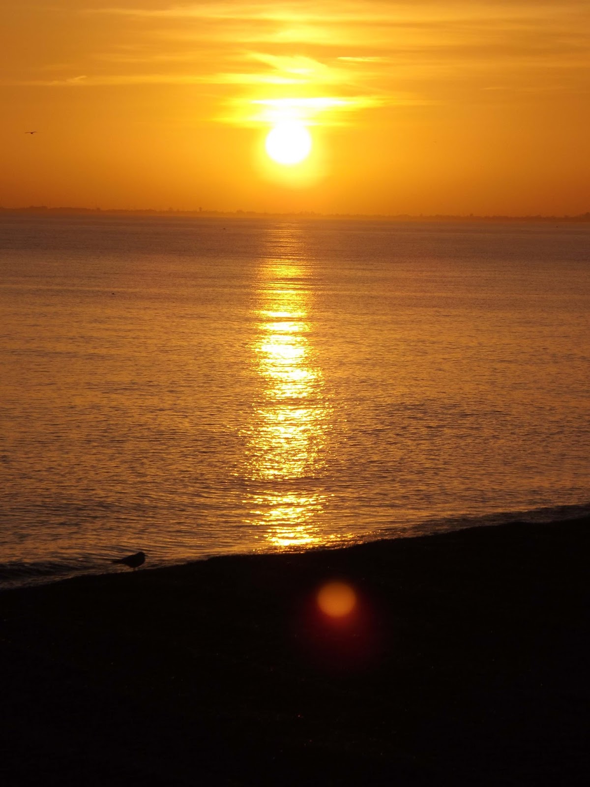
We walk on into Hythe after a long day as the sun begins to set.


We arrive in Hythe where we left the car.
Hythe is a small coastal market town on the edge of Romney Marsh, in the District of Shepway (derived from Sheep Way) on the south coast of Kent. The word Hythe or Hithe is an Old English word meaning haven or landing place.
The town has medieval and Georgian buildings, as well as a Saxon/Norman church on the hill and a Victorian seafront promenade. Hythe was once defended by two castles, Saltwood and Lympne. The town hall, a former guildhall, was built in 1794, its fireplace designed by the Adam Brothers.
Hythe's market once took place in Market Square (now Red Lion Square)
close to where there is now a farmers' market every second and fourth
Saturday of the month. Hythe has gardening, horse riding, bowling,
tennis, cricket, football, squash and sailing clubs. Lord Deedes was patron of Hythe Civic Society, and the hounds of the East Kent Hunt are kennelled in nearby Elham.
As an important Cinque Port
Hythe once possessed a bustling harbour which, over the past three
hundred years, has now disappeared due to silting. Hythe was the central
Cinque Port, sitting between Hastings and New Romney to the west and Dover and Sandwich to the east.
According to Hasted, a French
fleet approached Hythe in 1293 and landed 200 men, but "the townsmen
came upon them and slew every one of them: upon which the rest of the
fleet hoisted sail and made no further attempt".
In 1348 the Black Death afflicted Hythe, and in 1400 the plague further reduced the population.
Hythe has no coat of arms; but the corporation seal represents an
antique vessel, with one mast, two men in it, one blowing a horn; and
two men lying on the yard arm.
Hythe is also the birthplace of Mackeson Stout, a type of beer.
Hythe Ranges is a military training ground that takes up a large
section of the Hythe shoreline. Access to this section of the shore is
restricted when red flags are showing.

We pass a trailer "Gump Around The UK". Follow the Journey of Shane (Forest Gump / Friar Tuck / Badger) as he
walks / rides with his 6 rescue dogs as the mosey there way around the
coast of Britain raising money for Children with cancer
A bit from Shane
My reason for the 6.000 miles I'm about to walk and ride .over the last
3 years I nearly lost my life to cancer and was so I'll I was unable to
work which resulted in me getting into debt
then to knock the nail on the head my private rented property was sold
under my feet and I was given only 2 weeks to vacate so am now living in
my tent with my beautiful 6 rescue dogs the cubs and with no chance of
being rehoused I have decided not to become just another statistic when I
was sick the one thing that touched my heart was the bravery of
children that were very sick I have been given a second chance some of
the little ones I met wasn't so lucky so I have decided to walk ride the
entire coast of the UK to raise money for these children money raised
will not go towards a cure but just to better there days so donations
will go to one in a life time holidays and hospital equipment a crowd
funding page will soon be opened that I will not have access to any
donations would be amazing no matter the size i will not waste the time I
have been given I may not be able to change my situation but if maybe I
could change the children's then something amazing could come from a
bad situation thank you xxxx
#Gumparoundtheuk

 We reach the car dump our packs and head up the road to Park Road Chippy. I ordered the medium Cod and Chips, wish Id gone small now as it was a huge piece of fish with chips piled up. It was however a lovely piece of fish with crisp batter and lovely chips. Id recommend this place 7/10.


So after a 16.5 mile walk all in we set off home, tired but a great walk. One section left of the Kent coast. Next up Hythe to Dungeness.

GPX file here
Viewranger file here